Showing posts with label maps. Show all posts

Friday, October 7, 2022

East and South Queens redistricting maps leading to wider schisms

Queens Chronicle 

 Update

The Districting Commission voted to send the revised proposal to the City Council Thursday by a vote of 13-1, with one absence. 

ORIGINAL STORY

As the city’s meticulous reapportionment process draws on, the Districting Commission is set to vote on a revised proposal for City Council district lines today, Oct. 6.

Thursday’s meeting comes just two weeks after the commission voted 8-7 against its own proposal. The body spent three hours last Thursday night and four and a half hours last Friday tweaking the map, taking into account 286 items of public testimony that had come in after the rejection two weeks ago.

Among the most significant changes to the Queens lines to come from last week’s discussions is the return of part of Fresh Meadows to District 24. Councilman Jim Gennaro (D-Hillcrest) had taken issue with the previous draft in large part because, in moving that portion of the neighborhood to District 23, members of the area’s Orthodox Jewish community would be separated from the rest of the enclave. Should the commission approve that draft, District 24’s eastern boundary would be 188th Street, as it is now.

Asked for comment on the proposal, Gennaro said, “This community and I, as its representative, made our objections to the first two proposals loud and clear. Last Friday, the Districting Commission did the right thing by completely reuniting the Orthodox Jewish community within the 24th District.”

Later, he added, “We look forward to this plan being passed by both the commission and the City Council.”

THE CITY 

In the hours following the five-alarm Richmond Hill fire in June that ravaged a row of houses, killed three family members, and left more than 40 people homeless, Annetta Seecharran felt abandoned in her efforts to scramble for resources and support for the victims. 

Not one elected official showed up that day, Seecharran told THE CITY.

“I called and I called and I called,” Seecharran, who heads the Indo-Caribbean and South Asian community development organization Chhaya in Queens, told THE CITY. “And there was no response.”

Mayor Eric Adams visited family members the next day and said “the whole city is mourning.” Apart from that, however, Seecharran recalled this week how disheartening it was for her and other community members to have to fight for attention in the aftermath of that tragedy in City Council District 28, represented by Speaker Adrienne Adams. 

Seecharran, along with other locals and activists from Southeast Queens’ majority Indo-Caribbean and South Asian neighborhoods, gathered outside a Sikh temple in Richmond Hill on Tuesday with the fire in mind. 

Their goal: to call attention to the way electorally divided communities like theirs have been historically “underserved by the government” — and how the NYC Districting Commission’s draft map for new City Council districts, released in mid-July, would perpetuate that problem. As THE CITY previously reported, these redistricting efforts are part of a mandatory process to reflect population changes in light of the 2020 census and ahead of off-cycle elections in what will be newly drawn districts next year. Under the Voting Rights Act of 1965, the maps must not deny or dilute the voting power of racial and language minorities.

“Ultimately this is about power,” Seecharran told the crowd. “Our power has been limited because we have been divided.”  

But elected officials in other nearby neighborhoods have expressed a similar interest in keeping their predominantly Black communities from being divided between different districts. And they’re not alone: Across the city, various groups are pushing for map changes that would enhance their voting power in what can seem like a zero-sum game. All are racing to have their desires registered before the commission votes on a final map on Sept. 22. 

For example, a related battle is playing out in Brooklyn, as the draft map creates a new majority Asian council district in Brooklyn while splitting up what’s been a majority Latino district covering Sunset Park and Red Hook for the past three decades.

If nine of the 15 districiting commissioners agree on a map, it will then be released to the public and voted on by the City Council. If the draft does not get voted through, the commission would continue revising the map until passing one, though commission spokesperson Eddie Borges told THE CITY “that’s not even a prospect.”  

While eight of the 15 commissioners were appointed by the Council, five were selected by Speaker Adams, leader of the 44-member Democratic caucus. Minority Leader Joe Borelli, one of its seven Republicans, picked the other three, who potentially could join with the mayor’s members to pass a map.

In a letter addressed to the commission’s chairman and obtained by THE CITY, several elected officials in majority Black districts in southeast Queens outlined concerns about numerous ways that the draft map would divide and dilute voting power across their districts. Those officials include Majority Whip Selvena Brooks-Powers of District 31, which currently covers the eastern Rockaways, Laurelton, Rosedale, Brookville and parts of Springfield Gardens, and Councilmember Nantasha Williams of District 27, which currently covers Cambria Heights, Hollis, Jamaica, St. Albans, Queens Village, and Springfield Gardens. 

Among their concerns:

  • The removal of downtown Jamaica from District 27, and the inclusion of  parts of Springfield Gardens, which cuts across “the middle of different ethnic communities and neighborhoods,” according to the letter writers;
  • The removal of Rochdale Village from District 28, which is home to a minority-owned Mitchell-Lama cooperative: a 20-building complex housing 25,000 working-class residents, most of whom are Black;
  • The removal of parts of Springfield Gardens that are mostly Black from District 31, which would “misalign the community’s collective voice,” according to the letter-signers. The district would gain parts of the Rockaway peninsula that have a white plurality and of South Ozone Park that have an Asian plurality, according to an analysis by THE CITY.

Some community members shared similar concerns in a virtual town hall convened by Queens Borough President Donovan Richards on Wednesday night. Community Board 12 Chairperson Rev. Carlene O. Thorbs, for one, was firm that Rochdale should stay whole and intact.

“It doesn’t even make any sense that anybody even entertains that. The historical value in our area needs to stay the same,” Thorbs said. “We are still the largest voting bloc — we can’t even ignore that.”


Friday, April 8, 2022

A more equitable and rational Citibike expansion proposal for Queens


Juniper Park Civic 


The Citibike expansion to Queens got a good do over by Juniper Park Civic. Taking DOT's original proposals which would've usurped street curb spaces from residential and commercial parking (spitefully in my opinion) onto ample sidewalk spaces nearby them instead.
 
Let's see how Transportation Alternatives responds... 


Wednesday, March 30, 2022

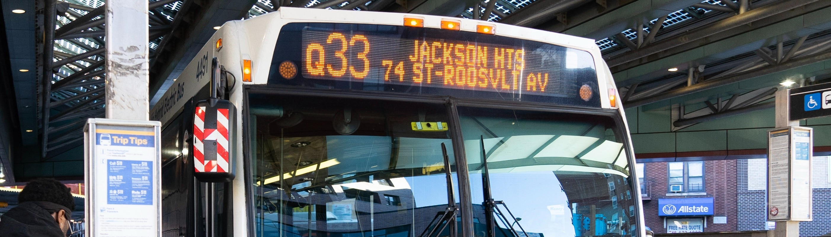
Here's your new bus map Queens

A bus with an electric screen at the top that reads Q53

MTA 

Here are what the MTA are calling the "remixed" express and the local lines

And Crappy pointed out that the transit agency made up a town called Fresh Pond in these maps. 


Queens Chronicle 

Proposals in 2019 by the Metropolitan Transportation to rework the entire bus system in Queens were roundly hammered by the public and elected officials.

In the two years that Covid-19 put the project on the far, far back burner, the MTA, as promised, reviewed the feedback it collected.

The preliminary draft was unveiled Tuesday at a Jamaica press conference that included MTA CEO and Chairman Janno Lieber, Borough President Donovan Richards and city Transportation Commissioner Ydanis Rodriguez.

“The Queens New Draft Plan is the third to be released, but in some ways, may be the most important of the five because Queens has, historically, had less subway service relative to its size and population than the other boroughs,” Lieber said. “So many people depend on buses for access to jobs, education, culture and everything else New York has to offer.”

Lieber acknowledged that the 2019 proposal was not well-received by the public. He said the new plan is an effort to increase the speed and frequency of service, balanced with convenience. He said the new plan applies to local and express service and emphasized that it still is a draft “to address the evolving needs of Queens communities, with a focus on more reliable service, faster travel, better connections, and ease of use.”

“A bus is mass transit in many parts of Queens,” he added. “It is the only way [in some areas] to connect to the subway system and the commuter rail system, so we are really emphasizing this.”

Craig Cipriano, New York City Transit’s interim president, also emphasized the draft nature of the document.

“This is going to be one of the largest bus redesigns in the country, with over 100 routes serving over 800,000 customers a day,” Cipriano said. “We’re eager to hear what you have to say, and there’s lots of room to make changes.”

Richards said the selection of Jamaica for the unveiling was no accident.

“For the residents of Queens who get up every day and go to bus stops, today is a great day,” Richards said. “If you come from Southeast Queens, like I do, you know it can take an hour just to get to one of the train stations here on Jamaica. I often joke, and it’s really not a joke, that it is easier to get to Florida by plane than it is to get to Manhattan from here on some days.”

While Richards said buses are a lifeline to parts of Eastern, Southeast and Southwest Queens, they often are unreliable, overcrowded and slow.

“The routes are outdated, and the schedules haven’t changed with our neighborhoods,” the borough president said. “They not only went back to the drawing board, they’re coming to us with a better product.”

One of the major complaints heard throughout community meetings in 2019 is that while eliminating some existing bus stops speeds up each bus trip, those who use those stops regularly will be at least slightly, maybe greatly, inconvenienced.

Lieber and Cipriano said the idea is to focus on stops that are closer together, which cost riders time at the curb.

“The focus is on connecting people more quickly to the subways and commuter railroads,” Lieber said in a question-and-answer session. “It also tries to balance the needs to move buses more quickly with the elimination of some bus stops while maintaining local bus service, especially with seniors.”

He said that is essential for anyone who does not live in an area close to subway lines.

“Buses have to be faster than walking,” he said.

Among the things Lieber said the city can do to help are things like signal prioritization for buses at traffic lights, and especially bus lanes.

Wednesday, January 5, 2022

Battle of the maps

https://cdn.vox-cdn.com/thumbor/uAYKfW6mIrIX4qMFF4mWqFMCPD0=/0x0:1200x800/920x0/filters:focal(0x0:1200x800):format(webp):no_upscale()/cdn.vox-cdn.com/uploads/chorus_asset/file/23143605/redistricting_and_you.png 

THE CITY


New York’s crucial once-in-a-decade redrawing of congressional and state legislative boundaries broke down along party lines as an “independent” redistricting commission for the second time proposed two competing sets of maps.

The impasse paves the way for lawmakers in Albany to take over the process, with no pretense of bipartisanship.

The 10-member commission –– created via a constitutional amendment approved by state voters in 2014 –– was meant to wrestle control of the map-making out of the hands of politicians after civic groups and Democrats expressed dismay over what they viewed as Republican gerrymandering following the 2010 census.

The group, made up of five Democrats and five Republicans, already had failed to coalesce around one set of maps in September.

At a public meeting on Monday, both sets of appointees complained that the other side wouldn’t compromise enough to make consensus maps possible. 

 Vice Chair Jack Martins, a Republican appointee, charged that Democrats stopped meeting with the GOP commissioners after Dec. 22.

Chair David Imamura, a Democratic appointee, said that Republicans never sent back counter proposals when his side asked for changes to their maps.

“It disturbs me to no end to see it end on this particular note,” said Elaine Frazier, a Democratic appointee to the commission. “We all worked very hard and I think we came so very close to agreeing with each other — we were surprised and in our surprise we pulled back from a consensus vote.”

Monday, August 27, 2018

More than 29K new dwelling units being built in Queens

From QNS:

A new interactive, real time map released by the Department of Buildings this week shows that Queens has approximately 21 million square feet of apartment space under construction, among other findings.

As announced in a press release on Aug. 22, the map shows the entirety of New York City’s nearly 200 million square feet of building space currently under construction, complete with details about each individual project and links to online copies of building permits. The map is the latest installment in the DOB’s initiative to share data with the public, following the release of the interactive map of sidewalk sheds earlier this year.

The map shows all active permits that have been filed with DOB, including new buildings and alteration projects. It automatically updates in real time as new permits are issued and existing permits expire. Users have the ability to filter through the data shown by building type, number of dwelling units, square footage, estimated cost, general contractors, community board boundaries and boroughs.

When filtered to show just the building projects in Queens, there are several interesting facts about the borough’s buildings.

There are a total of 2,450 active permits in Queens that comprise a total of 37,642,187 square feet of building space under construction in Queens. Of that, approximately 12 million square feet of space is being built in Community Board 2, covering Long Island City and Sunnyside.

In total, Queens has 29,451 dwelling units in the pipeline, and five buildings under construction in the borough rank in the top ten most dwelling units in the city.


29,451 new dwelling units, with probably about 1-200 that are affordable. And the 61,000+ citywide homeless population will keep growing.

Tuesday, January 10, 2017

NYC lacking in trees

From 6sqft via Metro:

In an effort to promote urban tree cover, researchers at MIT’s Senseable City Lab have developed Treepedia, a platform for mapping the canopies of ten different major cities. Using Google Street View panoramas to serve as a Green View Index (GVI) to compare and evaluate green canopy coverage, Treepedia provides a visual map of trees and vegetation in Boston, Geneva, London, Los Angeles, Paris, Sacramento, Seattle, Tel Aviv, Toronto, Turin, Vancouver and of course, New York.

Researchers chose GVI over satellite imagery so as to “represent human perception of the environment from the street level,” according to the Treepedia site. GVI is measured on a scale of 0 to 100. A city with a GVI of 100 would be completely covered by tree canopy.

New York ranked the third lowest of the ten cities, with only Paris and London having less tree coverage. With a GVI of 25.9 percent, Vancouver was found to have the most tree coverage.

Wednesday, October 19, 2016

Feds amend flood maps

From Crains:

Federal officials have agreed to amend New York City's flood maps a year after the de Blasio administration filed an appeal on the grounds the charts were too pessimistic.

The new maps will likely shrink the boundaries that dictate who must purchase flood insurance, and may prescribe lower flood elevations, which would save some building owners money in flood-insurance premiums.

"Our city needs precise flood maps that reflect real risks, both today and years from now—and we have to do that fairly," Mayor Bill de Blasio said in a statement.

Flood insurance is required for any homeowner in a flood zone with a federally backed mortgage, but for decades the government subsidized premiums, which came back to haunt the National Flood Insurance Program after payouts from a series of catastrophic storms depleted its cash reserves.

Thursday, March 17, 2016

Let's celebrate a 30-unit building on the site of a 1-family house

There's an interesting interactive map over at Curbed showing the projects planned for Flushing. Take a look at it. It's not 100% accurate, but you do get the sense of how desperately developers and the city are trying to stuff 10 lbs of sausage into a 1 lb bag.

Thursday, July 16, 2015

Climate change = buh-bye LIC

From Curbed:

New data published in Science shows that if the planet warms by 2 degrees Celsius, sea levels will rise about 20 feet. It's pretty much a given that this will happen, it's just a matter of when—it could be by the end of the century. A 20-foot rise is no where near Linn's extreme depiction of a 100-foot rise, but it would still radically alter our coastline. The group Climate Central created an interactive map (h/t Gizmodo) that shows what this would mean for major cities in the United States. In New York, it means that entire neighborhoods would be wiped out and 1.8 million people would be displaced.

It's gonna be like this year round!

Sunday, June 28, 2015

City disapproves of FEMA's flood maps

From the Daily News:

In a move to help homeowners who face the risk of drowning in huge insurance bills, the city is appealing new FEMA maps that nearly double the number of city properties in flood zones.

Officials say up to 35% of the area the feds designated as flood-prone is labeled inaccurately.

The FEMA maps, which came out in January, placed about 400,000 city residents in flood zones, up from 218,000 under the old ones. The feds’ huge flood zone included 71,500 buildings, nearly twice the 36,000 that the old FEMA maps had.

Many of the homes affected are in Canarsie, Brooklyn, and Howard Beach and the Rockaways in Queens.

Sunday, November 16, 2014

Find out where homeless families are hailing from

This is a great map that breaks down exactly from which NYC neighborhoods the homeless families are coming. Click on this link and then play around with it. It's fascinating.

Saturday, July 26, 2014

Pavilion vandalized

From the Daily News:

Vandals broke into the historic New York State Pavilion last weekend, setting a stolen van on fire and damaging a piece of its deteriorating terrazzo map, park watchdogs said.

The shocking mayhem in Flushing Meadows-Corona Park was heartbreaking for volunteers who have been working for years to spruce up the aging 1964 World’s Fair relic.

The tarp that covers the map was set ablaze, Piro said. The punks also used a cinderblock to smash the side of the aged map.

The incident ironically comes as support for the renovation of the rusting pavilion is at an all-time high.

Friday, December 13, 2013

City now has online crime map

From the Daily News:

The NYPD released a new online, interactive map Sunday that allows users to research major crime across the city.

The map plots the time and location of crimes by month, and for the current and prior year.

People can search the map by address, ZIP code or police precinct.

The crime-mapping website was mandated by city law earlier this year and created by the city’s Department of Information Technology and Telecommunications.

Wednesday, January 30, 2013

New flood maps a rude awakening


From the Daily News:

A whopping 35,000 city homeowners whose dwellings were lashed by Hurricane Sandy will now be forced to raise their houses by several feet or face skyrocketing flood insurance premiums.

The federal government Monday added the startling number of buildings to its flood danger zone maps for Brooklyn, Queens, Staten Island and Westchester County, exposing homeowners to new building codes, shrinking property values and other painful costs.

People whose homes are in the flood zone will have two years to elevate their buildings to protect them from surging seawater or begin to face huge spikes in their flood insurance premiums.

The increased premiums will be phased in over several years once the maps are adopted — likely in 2015.

Chunks of southern Brooklyn, the Rockaways and Staten Island not previously labeled at risk were added to flood zones on the new maps. Maps for Manhattan and the Bronx are due out next month.

Check them out here: region2coastal.com

Tuesday, January 15, 2013

Revised NYC flood maps will cost homeowners


From the NY Post:

Thousands of homeowners don’t realize it, but they’re about to get hit with another fiscal tsunami from Hurricane Sandy.

For the last six weeks, federal officials have been working with the city to redraw maps and expand flood zones that haven’t been changed since 1983.

It’s not hard to figure out where the new boundaries are headed: farther inland.

Mayor Bloomberg made that clear last month by disclosing that two-thirds of the homes battered by Sandy were beyond evacuation zones.

Neighborhoods that had never flooded before, such as Gerritsen Beach and East Williamsburg in Brooklyn, were suddenly under water.

“I’m sure there’s going to be a lot of properties not in the flood zone before and find themselves in now,” said Don Griffin, a vice president at the Property Casualty Insurers Association of America.

The redrawn maps will form the basis for new building regulations meant to contain damages from future storms.

But they’ll also jack up costs for homeowners.

Those planning to build or rebuild within a flood zone will have to meet strict height requirements to get above FEMA-designated flood levels. The lower down they are, the more it will cost.

Thursday, May 31, 2012

New online parking guide


From Crains:

New York City is launching an online map that will show drivers where and when it's legal to park.

The Department of Transportation and City Council officials announced the launch of the map Tuesday. The map is meant to help motorists decipher the parking rules for any block in the city.

City Councilman James Vacca, chairman of the Transportation Committee, says in a statement that the city's parking regulations can be as difficult to understand as morse code.

City Councilman Dan Garodnick says the idea for the map came from his mother, and he hopes it will save drivers some headaches.

Users can search the map by intersection or address. The map will show alternate-side parking schedules and other parking rules.

Friday, May 14, 2010

Man dies after FDNY gets lost

From the NY Post:

A Queens man died from lack of oxygen as confused firefighters circled his house for 37 minutes because they couldn't find the address on their outdated map, The Post has learned.

Tom Gallagher, 69, a retired stationary engineer for Fordham University, was in his bedroom at his Little Neck home on Van Nostrand Court just after 10 p.m. Monday when he lost consciousness, his distraught family said.

While his son tried to revive him, firefighters rushing to his aid drove by his cul de sac several times without spotting the entrance.

Their rig was not equipped with GPS or electronic maps -- which are not installed in any FDNY or EMS vehicles.

Instead, they relied on a 2005 Hagstrom map they keep on their dashboard.

Gallagher's family -- which includes a retired fire chief brother and a retired firefighter nephew -- called 911 at 10:21 p.m. to report a heart attack.

With the nearest ambulance five miles away in Flushing, the FDNY dispatcher alerted Engine Co. 313, located eight blocks from Gallagher's house, straight down Northern Boulevard. Inside the firehouse, a wall map has Van Nostrand Court added in black magic marker.

Engine 313 drove back and forth for several minutes along West End Avenue, which offers access to Van Nostrand Court, witnesses said.

At one point, they took off for a similar address in Van Nostrand Place in Douglaston before doubling back to Little Neck. They showed up 37 minutes after the call was placed.

Gallagher's family was later stunned to learn he had died from lack of oxygen, not a heart attack.

Thursday, April 1, 2010

He deserves a break today

Please note:

Maspeth is now two words: Mas Peth.

Also, the Google Maps truck driver likes McDonald's.

Tuesday, March 2, 2010

City wants to study Texaco map

From Ink Lake:

This past summer and autumn, volunteers under the aegis of the city Parks and Recreation Department, removed the vegetation that had sprouted (and was cracking the tiles apart). A layer of sand was then placed over the floor, and then a geotextile was placed on top, finally covered by a layer of gravel.

The city has applied to the state for an Environmental Protection Fund grant to conduct studies of the condition of the towers and other structures. If the funding is obtained, based on the results of those examinations, next steps can be decided.

At least things aren’t getting any worse.


Well, if the soon-to-be-ex-governor's cuts to the EPF stand, then it's not likely the funding will be obtained. The loss of the EPF fund is threatening zoos, botanical gardens and aquaria as well as proposed park projects.