Showing posts with label gerrymandering. Show all posts

Thursday, July 28, 2022

Party transfer crashers might effect August primary elections

 https://nypost.com/wp-content/uploads/sites/2/2022/07/dem-gop-primary-voting-057.jpg?quality=75&strip=all&w=744

 NY Post

The Democratic Party’s gerrymander debacle has created an extraordinary situation: New Yorkers are allowed to switch their party affiliation at the ballot booth on Aug. 23 to vote in another party’s primary elections. 

Under normal circumstances, a voter had a Feb. 14 deadline to change party affiliation for primary elections scheduled in June.

But since judges nullified the Democrats’ partisan gerrymandered district maps — which GOP critics labeled a Hochulander since Gov. Kathy Hochul signed off on them — for Congress and state Senate and ordered primary elections on Aug. 23 based on districts redrawn by a court special master, that deadline no longer applies.

Registered independent or unaffiliated voters can join a party to vote in a contested primary race and registered Republicans or Democrats could temporarily change their party affiliation and crash another party’s primary races for Congress or state Senate. 

For example, Republicans or independents could decide to re-enroll in the Democratic Party to vote in the contested primary between Reps. Jerry Nadler and Carolyn Maloney and Suraj Patel in the 12th Congressional District covering the East and West sides of  Manhattan.

Or Republicans or unaffiliated voters could switch registration to Democrat to vote in the crowded 10th Congressional District primary covering lower Manhattan and brownstone Brooklyn. Candidates include Councilwoman Carlina Rivera, Assemblywoman Yuh-Line Niou, House impeachment lawyer Dan Goldman, Rep. Mondaire Jones, former Congresswoman and Brooklyn DA Elizabeth Holtzman and Brooklyn Assemblywoman Jo Anne Simon, among others.


Friday, April 29, 2022

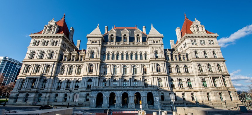
New York Democrats gerrymandering attempt kiboshed

https://cdn.cityandstateny.com/media/img/cd/2022/04/27/new_york_state_capitol_Roy_RochlinGetty_Images/860x394.jpg?1651084427

City and State 


New York’s highest court tossed out both congressional and state Senate district maps on Wednesday, ruling that they were both drawn in violation of the constitution.

In a majority 4-3 decision, the state Court of Appeals ruled that the maps must be redrawn by a neutral expert, acknowledging that “it will likely be necessary to move the congressional and senate primary elections to August,” Chief Judge Janet DiFiore wrote, ordering the Supreme Court to oversee the process.

While the court ruled both maps were procedurally unconstitutional, the judges wrote that the congressional map was clearly gerrymandered “with impermissible partisan purpose.”

The decision comes after the new, bipartisan Independent Redistricting Committee, established by voters in 2014, failed to come to an agreement on the electoral maps, putting the power in the hands of the Democrat-controlled state Legislature, which approved the newly redrawn maps in February. 

“The legislature responded by creating and enacting maps in a nontransparent manner controlled exclusively by the dominant political party – doing exactly what they would have done had the 2014 constitutional reforms never been passed,” DiFiore wrote. 

The now-voided maps would have given Democrats advantages in 22 of the state’s 26 congressional districts. The new state Senate map redistributed two more of the 63 districts to New York City, following population trends, and gave  Democrats a better position in three Republican-held districts. 

After Democrats released the maps, Republicans promptly filed a lawsuit arguing that the process for approving the maps was “constitutionally defective” and that the congressional map in particular was “unconstitutionally gerrymandered in favor of the majority party,” according to the decision issued Wednesday.

Friday, April 1, 2022

Hold the lines

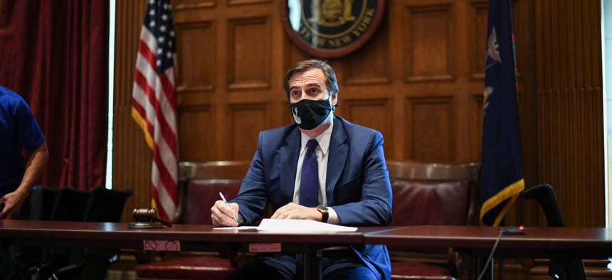
 https://www.mikegianaris.com/wp-content/uploads/2022/03/State-Sen.-Mike-Gianaris-on-new-legislative-session-in-Albany_JAN.jpg

Queens Chronicle

A New York State judge struck down the recently agreed upon legislative maps Thursday afternoon, sending state lawmakers back to the drawing board. They have until April 11 to agree upon new maps, the ruling says; the previously approved maps are not to be used in the upcoming election cycle. 

This comes hours after legislators left Albany for the weekend, doing so without the state budget — which expires at midnight — approved. 

The maps just nixed by Acting Supreme Court Justice Patrick McAllister of Steuban County were the culmination of a drawn-out redistricting process following the 2020 Census. For the first time in its history, the state had given an Independent Redistricting Committee the task of drawing the lines; when the committee failed to reach an agreement, at the end of January, the Democrat-controlled Legislature took up the mantle as it had in years past.

The ruling includes the proposed maps for New York’s congressional, state Senate and Assembly districts.

Soon after that, Republicans filed a lawsuit challenging the lines, as many anticipated. Asked about a possible challenge at the time, state Sen. Mike Gianaris (D-Astoria), who has been on the front lines of the redistricting fight, told WNYC’s Brian Lehrer, “When the time comes, we’re confident we’ll make our case to the court and be successful.”

Wednesday, February 2, 2022

Albany Democrats present blatantly gerrymandered redistricting map, Gianaris claims it's justified

 State Senate Deputy Majority Leader Michael Gianaris, who has led his chamber’s redistricting efforts, asserted that his party did not engage in gerrymandering.

 NY Politics

A new and long-awaited proposed New York congressional district map was released by the Senate and Assembly on Sunday. As a result of the 2020 census, the map reflects the state’s loss of one congressional district, bringing the state’s delegation down to 26 members.

New York State legislators are expected to pass the map later this week and send it to Governor Kathy Hochul for her approval. New maps for New York State Assembly and Senate district maps are also expected to be released and approved later this week. Following those enactments, county boards of elections will realign election districts with the new Assembly Jdistricts so petitioning for Spring 2022 primaries can get underway in early March.

The task of drawing the initial line drawing fell to the New York State Legislature after the state’s advisory “Independent Redistricting Commission” failed to agree on congressional and state legislative maps in early January. The commission had been created under a 2014-enacted state constitutional amendment that aimed to remove the legislature from the initial line-drawing process.

This map represents the first opportunity for Democratic Party legislative leaders to manage drawing the state’s congressional maps in 90 years.  In those prior years, Republicans or a politically divided legislature drew the maps. The current congressional lines were drawn by a federal court in 2012 after the legislature failed to come to an agreement on a map.

City & State

State Senate Deputy Majority Leader Michael Gianaris, who has led his chamber’s redistricting efforts, asserted that his party did not engage in gerrymandering despite proposing a new congressional map that clearly benefits Democrats. In an interview with City & State, Gianaris stood by the controversial proposal that could cut the number of Republicans in the New York delegation in half.

The maps clearly disadvantage Republicans, who will likely lose four seats in the next election cycle if the proposal stands. The GOP was quick to denounce the new lines and promised to take the matter to court. But they weren’t the only ones crying foul. The left-leaning think tank Brennan Center for Justice, which focuses on voting rights, said Democrats took a heavy hand to district drawing. Michael Li, the organization’s redistricting expert, called the New York maps an “aggressive gerrymander,” and even asserted they would be struck down under the John Lewis Voting Rights Act that Democrats are championing in Congress. 

Still, Gianaris defended the maps against claims that they were overly partisan, especially in some of the most unusually shaped districts. “We’re very confident this adheres to the current requirements,” Gianaris said, adding that he fully expects the issue to end up in court. “Other people make those decisions, we’ll make our case why we believe it does.”

Given specific examples of districts that have drawn scrutiny, Gianaris offered a legal claim for each. For District 11, currently held by GOP Rep. Nicole Malliotakis, he claimed the new lines “conform to some historical norms for that district” – which apparently just happen to turn the right-leaning swing district into a fairly safe Democratic seat. Expanding District 3, being vacated by Democratic Rep. Tom Suozzi, from Long Island into the Bronx and Westchester unites communities of interest along the Long Island Sound, according to Gianaris. He added that this particular decision came from public input from a coalition representing communities of color that presented a “unity” plan, but the move seemed to baffle many. 

 Democrats have been accused of using redistricting to strengthen their position in the state Legislature despite criticizing gerrymandering in the past. “As we unravel the gerrymanders of the past, it doesn't make it a gerrymander of today,” state Senate Deputy Majority Leader Michael Gianaris, who chaired the legislative task force that oversaw redistricting along with Assembly Member Kenneth Zewbrowski from the Hudson Valley, said on The Brian Lehrer Show Tuesday. “These are districts that are drawn fairly,” Gianaris added. Whether or not Gianaris’ rationale rings true despite the proposed Democrat-friendly lines, Republicans did use methods other than line-drawing to help them maintain their state Senate majority in the past. Packing more people in Democratic districts versus GOP areas was one strategy.

Friday, January 28, 2022

Gerrymandering Nikki

 https://nypost.com/wp-content/uploads/sites/2/2022/01/malliotakis-seat-redistricting-149.jpg?quality=90&strip=all&w=744

 NY Post

Democrats who control the state Legislature are plotting to knock off Rep. Nicole Malliotakis — the only Republican member of New York City’s congressional delegation — by redrawing a legislative district to add liberal Brooklyn precincts to her Republican stronghold, sources told The Post Wednesday night.

The Democrat’s plan would drastically alter the 11th congressional district, which combines Staten Island, her political base, with some more conservative areas of southern Brooklyn, including Bay Ridge, Bath Beach and Dyker Heights.

Under the redistricting plan that would go into effect for elections later this year, the district would include Bay Ridge but then snake northwest and take in the more heavily liberal Democratic neighborhoods of Sunset Park, Red Hook, Gowanus, Windsor Terrace and Park Slope, legislative sources said.

“Those are big Democratic areas,” one legislative source said.

Legislative insiders said if a Democratic candidate can run up the score with 80 percent of the vote in the Brooklyn side of the district, he or she can win by capturing about 40 percent in more conservative Staten Island.

The 11th CD is considered a purple or bellwether district as currently constituted. 

 Malliotakis defeated one-term Democratic incumbent Max Rose in the 2020 elections, aided by a strong showing by former President Trump in the district. Rose is seeking the Democratic nominations again in a potential rematch.

Brooklyn Democrat Assemblyman Robert Carroll, whose district takes in all of Park Slope and who graduated from Xaverian HS in Bay Ridge and has family roots there, has told politicos he is considering running for the redrawn congressional seat, sources said.

The Democratic primary also includes Democratic socialist Brittany Ramos DeBarros, who, like Rose, is an Army veteran who served in Afghanistan.

Malliotakis told The Post she’s a victim of a partisan hit job. 

“The people of this district and the state of New York voted not once, but twice, for non-partisan redistricting. To gerrymander a blatantly partisan map dilutes the voice of my constituents, defies the will of New York’s voters, and is a direct assault on the state constitution,” Malliotakis said.

Saturday, April 13, 2019

Hudson Yards was made possible with pilfered EB-5 funding that was meant for public housing developments through enabled cirvumvention and crooked gerrymandering


City Lab


Since its official unveiling last month, critics have been teeing off on Hudson Yards, the $25 billion office-and-apartment megaproject on Manhattan’s West Side. The Guardian’s Oliver Wainwright calls it “bargain-basement building-by-the-yard stuff that would feel more at home in the second-tier city of a developing economy.” In Curbed, Alexandra Lange writes that it suffers from “no contrast. No weirdness, no wildness, nothing off book.” The New York Times’ Michael Kimmelman describes it as a “vast neoliberal Zion.”

“New York politics and real estate are notoriously akin to Rashomon,” reads Kimmelman’s review. 

“Any verdict on an undertaking as costly and complex as Hudson Yards depends on one’s perspective.”

Views abound, sure, but so far, nobody seems to like what they see when they look at Hudson Yards. 

The project has managed to do something unique: unite all New Yorkers in a vernal equinox of acid contempt. Early reviews offer a litany of contrasts, with the development’s garish geometry and dull placelessness earning rebuke in equal measure. That’s before considering how certain features, particularly Thomas Heatherwick’s oft-derided shawarma-shaped bucket, square with other projects as “bellwethers pointing to exactly where our cities are going awry.”


However, among all the many reasons to feel salty about Hudson Yards, one perspective may deserve a place of privilege: the view from Harlem. Without their knowledge, the residents of a number of public housing developments helped to make Hudson Yards possible. The mega-luxury of this mini-Dubai was financed in part through a program that was supposed to help alleviate urban poverty. Hudson Yards ate Harlem’s lunch.


Specifically, the project raised at least $1.2 billion of its financing through a controversial investor visa program known as EB-5. This program enables immigrants to secure visas in exchange for real estate investments. Foreigners who pump between $500,000 and $1 million into U.S. real estate projects can purchase visas for their families, making it a favorite for wealthy families abroad, namely in China. EB-5 is supposed to be a way to jumpstart investment in remote rural areas, or distressed urban ones.


Hudson Yards, of course, is nobody’s idea of distressed. Located at the source of New York’s High Line, it’s the most expensive real-estate project in U.S. history. It could not possibly qualify as distressed under the terms of the program, or any understanding of the word. In order to buy EB-5 visas at the lower rate ($500,000), immigrant investors must put their money behind projects in areas with high unemployment—a proxy for need.

 Manhattan’s West Side may not suffer for lack of opportunity, but, as Kimmelman notes, New York real estate is a realm for Kurosawa-esque visionaries. The Related Companies, the developer behind Hudson Yards, raked in at least $1.2 billion in EB-5 funds for this project. To qualify, Related needed a work-around to bypass the distressed-area requirements—a pass that New York authorities were happy to issue.


Here’s how these requirement works: EB-5 visa applicants must invest a minimum of $500,000 in a project within a designated geographic area called a targeted employment area, or TEA. To be eligible for this financing, a project needs to qualify as falling within a TEA—which is going to be either a rural area or a distressed urban area. For an urban area to count as a TEA, it has to meet a certain unemployment threshold (150 percent of national unemployment).

 Lower Manhattan doesn’t meet this unemployment threshold, so Hudson Yards, on its own, can’t qualify as a distressed urban area. However, when Congress created the EB-5 visa as a part of immigration reform legislation in 1990, lawmakers did not specify how states should draw up the geographic boundaries for a TEA.


New York takes a rather liberal approach to drawing these lines. Empire State Development, the economic development agency for the New York state government, determines the boundaries for qualifying TEAs. Under state law, the agency has the authority to string together an unlimited number of census tracts in order to achieve the desired aggregate unemployment standard. Think of it as a form of creative financial gerrymandering.  

As I reported back in 2017, records obtained by CityLab under the Freedom of Information Act reveal the gerrymandered map that Empire State used to qualify Hudson Yards for EB-5 financing. This particular TEA snakes up from the West Side and includes Central Park. (Think about that: a map of Manhattan that claims Central Park as an economically troubled area.) Beyond the park, the qualifying zone for Hudson Yards captures several census tracts in Harlem, where public housing projects boost the overall unemployment figure.   

 These funds might have financed alternative developments in Harlem directly. Other developers have successfully raised EB-5 funds for projects in actually distressed areas of New York. For example, Asian Americans for Equality, a nonprofit organization, once pursued EB-5 funding to finance a food hub and university project in northeast Kansas City, a grocery store destroyed by Hurricane Sandy in the Far Rockaways, and an affordable housing complex in Queens’ Flushing neighborhood.  


Instead, Related sopped up hundreds of millions in funds never intended to finance luxury projects. 

The developer has successfully leveraged Harlem unemployment to raise more in EB-5 financing than any other developer in the nation. Related recently sought a third tranche of EB-5 funds for Hudson Yards, targeting $380 million—bringing the total as high as $1.6 billion, according to New York University’s Stern Center for Real Estate Finance Research.


Wednesday, August 20, 2014

Lawsuit over 2022 redistricting

From Epoch Times/AP:

A government watchdog group is challenging the wording of a ballot question on redistricting, saying the referendum on this fall’s ballot is deceptive.

Common Cause-New York announced the lawsuit Tuesday. The organization is one of several that have criticized the ballot question, which will ask voters to authorize a new commission to handle redistricting beginning in 2022. That’s the next time the state’s political districts will be redrawn to account for population changes.

The referendum says the commission will be independent, even though top lawmakers would pick eight of its 10 members, and the Legislature would have the power to reject any commission proposal it didn’t like.

Common Cause Executive Director Susan Lerner, a plaintiff in the suit, says the proposition is misleading and should be rejected.

Wednesday, December 12, 2012

How's this for tweeding?


The Districting Commission's latest round of maps includes gerrymandering Broad Channel into two districts. West of the black line is Council District 32 and east of the line is 31.

It's hard to believe that the tiny population of the island couldn't be kept together in one district. The row of homes east of Cross Bay Blvd and north of East 6th Road will now be in James Sanders' current district while the rest of the island is in Eric Ulrich's district. I suppose the Commission figured that no one in Broad Channel would catch this since they are still recovering from the storm damage. Nice try, guys!

Sunday, November 18, 2012

Revised redistricting maps even worse

If you go to this link, you'll download the revised version of the NYC Districting Commission's proposed City Council district maps.

To summarize:

The Districting Commission's role is supposed to be to maintain communities of interest, which includes ethnic as well as well-defined neighborhoods with long-maintained boundaries. After the initial maps were drawn, the Commission came under great scrutiny for not doing very much at all and making all sorts of decisions that seemed contrary to their stated mission. They assured the public - and the elected officials - that the first map was "just a draft" and there would be great opportunity for the public to help to shape the process.

The maps as proposed by the Commission are quite damaging for Queens neighborhoods. Not only were certain areas not corrected as had been suggested, other areas that have always maintained cohesiveness within one district or another have been dramatically divided.

Here's a sample of what's wrong:

Mitchell-Linden - After putting the area west of Union Street into the 19th Council District, the Commission made a motion to place it back in the 20th, as per the wishes of the community. However, now the part of Mitchell-Linden east of Union Street has been placed in the 19th.

North Flushing - North Flushing north of 33rd Avenue west of 150th Street was placed in the 19th; groups had requested all of the R2A area, which includes a number of blocks between 33rd and 34th Avenues, again to keep the neighborhood intact.

Broadway-Flushing - Instead, the Commission dragged the 33rd Avenue boundary all the way to 169th Street, dividing Broadway-Flushing in two. Also, at 169th Street, the District line makes a right angle south all the way to Flushing Cemetery, severing off the most eastern blocks of Broadway-Flushing as well. It is scarcely believable that Broadway-Flushing, which has a clearly defined boundary at Northern Boulevard, has been divided in this fashion.

Station Road - Similarly, the Station Road area was previously divided north and south, mostly by Northern Boulevard. This is one of the few civic areas that straddles Northern Boulevard due to the entire area being zoned R2 or R2A. Now the area has been divided east and west at 169th Street, again with little rhyme or reason.

There are many council members who are unhappy with the way the lines were drawn. But if the council doesn't vote to reject this map by December 7th, the lines are accepted as is and will stay that way for the next 10 years.

Saturday, October 20, 2012

Profiles in gerrymandering: Woodhaven, Kew Gardens and Richmond Hill

Redistricting Maps 3
From Queens Civic Congress:

Woodhaven / Richmond Hill / Kew Gardens

The Commission has proposed a wholesale shift in Council District representation for
Woodhaven, Richmond Hill and parts of Kew Gardens, moving well over 200 blocks
between the 28th, 29th 30th and 32nd Council Districts. The area is divided into five
neighborhoods (Figure 17): Woodhaven, Woodhaven North, Richmond Hill, Richmond
Hill North and Kew Gardens. All of Woodhaven and 1/3 of Woodhaven North is
presently located in the 32nd Council District, while the rest of Woodhaven North,
Richmond Hill North portions of Richmond Hill and Kew Gardens are located in the
30th. The rest of Kew Gardens and a portion of Richmond Hill are in the 29th, and the
remainder of Richmond Hill is located in the 28th (Figure 14).

The Council District boundaries proposed by the Commission (Figure 15) represents a
significant change in representation in what QCC believes to be not in the best interests of these important areas of Queens. The character of these neighborhoods is rather specific: Woodhaven North is comprised mostly of two-family detached houses, while the remainder of Woodhaven is more typically a mix of detached houses, rowhouses and small apartment buildings; Richmond Hill North is comprised mostly of one-family detached houses, while the remainder of the area is also similar mix to Woodhaven. Kew Gardens is largely split between areas containing large single-family houses, two-family rowhouses and six-story apartment buildings.

Richmond Hill North and Kew Gardens also have the distinction of being the first
suburban planned communities in Queens County, developed by the Man family between
1870 and 1930. These neighborhoods, which have tenacious civic organizations including the Kew Gardens Civic Association and the Richmond Hill Historical Society, are adamant about not being split between several Council Districts, and the Queens Civic Congress agrees with them.

The main natural and manmade boundaries in these neighborhoods are quite prominent
and obvious: The Brooklyn-Queens County line on the west; the Long Island Railroad
trestle between Woodhaven and Richmond Hill in the center; and the Van Wyck
Expressway on the east.

From north to south, the boundaries are Forest Park and the Jackie Robinson Parkway;
Jamaica Avenue, which acts as both a commercial center and a visual dividing line
(including in housing type) due to the elevated subway; and Atlantic Avenue on the
south. Additionally, Richmond Hill North and Kew Gardens have a specific boundary
line delineated when the areas were developed over a century ago.

QCC has proposed certain common sense boundary adjustments based upon the
geography and natural boundaries of these neighborhoods (Figure 16) which will cause
decreased disruption to the shape and content of the current Council Districts. We believe that, for the most part, Jamaica Avenue should act as the boundary between the 30th and 32nd Council Districts as it is being proposed between the 28th and 29th Council Districts; the only exception to this is a section between the Long Island Railroad trestle and 111th Street that would continue south to Atlantic Avenue, which would remain in the 30th Council District (which represents most of that area presently).

Additionally, the QCC proposes that a section of Woodhaven between Woodhaven
Boulevard and the Long Island Railroad from Jamaica to Atlantic avenues would be
moved to the 32nd Council District, as would an area of South Richmond Hill south of
Atlantic Avenue and east of the Long Island Railroad trestle (Figure 16).
The 29th and 30th Council District lines between Richmond Hill North and Kew Gardens
would also be shifted to reflect the actual boundary between these two discrete
neighborhoods.

Meanwhile, the Woodhaven Residents Block Association has its own proposal.

Friday, October 19, 2012

Profiles in gerrymandering: Astoria, Maspeth & Woodside

Redistricting Maps 3
Ditmars / Astoria

The Commission has proposed moving a geographically large portion of the present 22nd Council District - including Rikers Island and LaGuardia Airport - into the 21st. These changes, while fairly significant, do not affect the residents of the 21st or 22nd Council Districts. However, a six-block portion of Ditmars near the Rikers Island Bridge and LaGuardia Airport has also been proposed to move from the 22nd Council District to the 21st. The QCC opposes this seemingly arbitrary move, which isolates a small portion of Ditmars from the rest of the neighborhood.

Woodside

The Commission has proposed moving several areas in Woodside from the 26th Council District to the 22nd. While QCC agrees with many of these changes, an 8 block area adjacent to the Brooklyn-Queens Expressway near Broadway should be retained in the 26th Council District, as it is an immediate continuation of the neighborhood to the south.

Maspeth

The Commission has proposed to radically alter the 30th Council District on both its northerly and southerly boundaries. This includes moving approximately 40% of Maspeth from the 30th Council District to the 26th (Figures 14, 15 and 16).

Prior to the 2000 census, Maspeth was divided between three Council Districts: the 26th, 29th and 30th. When the area was redistricted in 2003, a successful effort was undertaken by the Juniper Park Civic Association, which represents Maspeth and Middle Village, to unite 90% of Maspeth into one Council District - the 30th (Figure 17). The Commission's proposed redistricting will undo this previous work and once again divide Maspeth The QCC proposal supports Juniper Park Civic Association in its appeal to keep Maspeth mostly intact within the 30th Council District.

The geography and street grid of Maspeth are unique in that the Long Island Expressway literally plows through the center of the Maspeth commercial district, dividing the southern portion of Grand Avenue from the northern portion. However, the lines that the Commission are proposing use Grand Avenue itself as a significant dividing line, even south of the Long Island Expressway. Dividing Maspeth in this fashion will only complicate the ability of the community to get fair representation, as significant coordination will have to occur between elected officials, civic organizations and business groups in order to have any action taken on a particular issue.

The Juniper Park Civic Association and QCC have devised an alternate plan (Figure 15) that would remove less than 20% of Maspeth from the 30th Council District - keeping 62 blocks within the 30th and moving 52 blocks to the 26th - while guaranteeing that the commercial district along Grand Avenue on both sides of the Long Island Expressway remains primarily within one Council District.
____________________________________________

In other words, Liz Crowley doesn't want the half of Maspeth that includes the St. Saviour's-Martin Luther park sites that she fucked up so badly to be in her district anymore. Plus, her most formidable opponent lives in the excised area. So she got this stupid, gerrymandered plan proposed by her cronies on the board to protect her incumbency.

Thursday, October 18, 2012

Profiles in gerrymandering: Cambria Heights and Springfield Gardens


Cambria Heights

The Commission has proposed that 52 blocks located in southern portion of Cambria
Heights (Figure 11) be moved from the 27th Council District to the 31st. Concerned
Citizens of Laurelton, the civic organization that represents the adjacent blocks
immediately to the south, has voiced their opposition as has the Cambria Heights Civic Association, which is strongly in favor of retaining these 52 blocks in the 27th Council District. The boundary between Cambria Heights and Laurelton has been well established for over a century as the north end of Montefiore Cemetery and 121st Avenue. By moving approximately 1/3 of Cambria Heights into the 31st Council District, the Commission is splitting this well-defined community and weakening its political representation. QCC believes that the Commission should reverse this proposed redistricting and keep all of Cambria Heights in the 27th Council District.

Springfield Gardens

Significant portions of Springfield Gardens have been proposed by the Commission to be removed from the 31st Council District and placed in the 27th and 28th Council Districts (Figure 11). In particular, the 23 blocks of Springfield Gardens north of the Belt Parkway between Baisley Pond Park and Guy Brewer Boulevard proposed by the Commission should be retained in any new plan. Otherwise, QCC agrees with relatively few of these proposed Commission changes and believes that significant areas should revert back to their existing districts (Figure 12).

Area civics do not agree with the Commission's plans to move 32 blocks south of the Belt Parkway that are being proposed by the Commission to be moved to the 28th Council District from the 31st. The Belt Parkway acts as a major dividing line between these sections of Springfield Gardens; they are essentially two separate neighborhoods (Figure 13). Placing half of the area south of the Belt Parkway into a separate Council District will significantly weaken the ability for this area to have fair political representation and, frankly, cause an area already isolated due to its immediate proximity to Kennedy Airport and surrounding industrial areas to be even more marginalized.

Similarly, two other discrete areas of Springfield Gardens - a 24 block area just west of Springfield Boulevard south of Merrick Boulevard; and a 25 block area south of Rochdale Village (Figure 13) - should remain in the 31st Council District for similar reasons, as they do not relate to other areas adjacent to them and have more "common interests" with the neighborhoods to the east. QCC believes that the Commission should reverse these proposed changes and have these blocks remain within the 31st Council District.

Wednesday, October 17, 2012

Profiles in gerrymandering: Mitchell-Linden

Redistricting Maps 1
Whitestone / North Flushing

The Commission has proposed that six blocks of the Mitchell-Linden apartment complex,
six-story buildings located west of Union Street, should be removed from the 20th
Council District and placed into the 19th (Figures 1 and 2). These blocks - which
represents only about half of the Mitchell-Linden Civic Association area - were curiously carved out of the 20th, seemingly with no context; not only did it divide a previously united neighborhood, it is surrounded on three sides by the 20th, with its only connection to the 19th adjacent to the Whitestone Expressway on the west, across from the College Point Corporate Park.

Based on conversations with the Mitchell-Linden Civic Association, the Queens Civic
Congress believes that these six blocks should revert back into the 20th Council District.

An appropriate addition to the 19th from the 20th would be the portion of North Flushing located in the 20th (Figure 3) - both in terms of comparable population (Figure 7) - as the remainder of this area is already in the 19th.

The North Flushing area - approximately 38 blocks, or 25%, of the primarily detached
single-family, low-density R1/R2 residential neighborhood (Figures 4, 5 and 6) north of Northern Boulevard that stretches between Union Street and Francis Lewis Boulevard - is currently located in the 20th Council District. It has no relation to the adjacent areas of high-density downtown Flushing to the south or the Mitchell-Linden Cooperative apartment buildings to the west, but is consistent and has a "common interest" with the rest of North Flushing to the east and should be placed entirely within the 19th Council District. QCC's recommendation is supported by the North Flushing Civic Association, which represents the immediate area, as well as the adjacent organizations to the east:

Broadway-Flushing Homeowners Association, Bowne Park Civic Association,
Auburndale Improvement Association and the North East Flushing Civic Association.
This "district swap" has also been endorsed by the Mitchell-Linden Civic Association.
In addition, two blocks should be added to the 20th from the 19th: a single block of
garden apartments in Whitestone at 20th Avenue and Parsons Boulevard; and a block
filled with six-story apartments at Northern Boulevard between Murray and 153rd
Streets. These changes would generate less gerrymandered district lines as well as
including higher density in District 20 where it is more in keeping with other similar areas.

Monday, October 15, 2012

Profiles in gerrymandering: Bayside Hills/Auburndale

From Bayside Patch:

Community Board 11 leaders are calling the city’s redistricting commission not to break up several northeast Queens communities that the board serves with new City Council district lines.

Jerry Iannece, the board’s chairman, wrote a letter to the commission this week to voice concern that new proposed lines would split Bayside Hills between two districts and Auburndale between three districts.

“It’s gerrymandering at its worst,” Iannece said. “I think it’s wrong and it’s political. Bayside Hills is split down the middle and Auburndale is split between three separate districts.”

Under the proposed lines, Bayside Hills would be shared by the 19th and 23rd Council districts, while Auburndale would be split between the 19th, 20th and 23rd.

“I don’t care where Bayside Hills goes, but it should be held intact in one district,” Iannece said. “And the housing stock and local issues in Auburndale are different from those in the 20th district, which is downtown Flushing.”


In other words, someone really doesn't want Jerry to have a base should he run for office again.

Here's the excerpt from the Queens Civic Congress' report:


Auburndale / Station Road / St. Kevin's

The Commission has proposed that five blocks of Auburndale in the St. Kevin's
neighborhood be moved from the 20th to the 19th. While the Auburndale Improvement
Association and QCC agree that these blocks should be retained in the 19th, we also
believe that the rest of the blocks north of 46th/48th Avenue between 166th to 196th
streets should also be added to the 19th from the 20th.

The area between 166th Street and Utopia Parkway - the Station Road area in Auburndale - is currently divided between the 19th and 20th Council Districts. The well-defined neighborhood, almost entirely located in a detached single-family zone (Figures 4, 5 and 6), from the Long Island Railroad to 46th Avenue. The portion to the north of Northern Boulevard and two individual blocks to the south are located in the 19th, with the remainder located in the 20th. The Station Road Civic Association, which also represents the area, has stated that it is against the current split between two Council Districts.

To the west lies East Flushing, with significantly higher zoning and population density, while to the east is the St. Kevin's neighborhood which has a preponderance of one and two-family detached houses. Additionally, the blocks immediately south of St. Kevin's Church are several blocks of one-family rowhouses; half of those houses are in the 19th, while half are in the 20th. Overall, the St. Kevin's neighborhood is evenly split between the 19th and 20th Council Districts presently. QCC believes that these 28 blocks, along with the 5 already proposed by the Commission, should be added to the 19th as they have similar zoning, neighborhood character and demographics (Figure 8).

Auburndale / Francis Lewis Boulevard

The Francis Lewis Boulevard corridor from the Long Island Expressway to 48th Avenue is a politically confusing area, with jagged lines unnaturally dividing the area. The Auburndale Improvement Association and QCC believe that the Council District lines should reflect the major boundaries of the area - Francis Lewis Boulevard and 48th Avenue, which are both major roads - in dividing the area between the 19th, 20th and 23rd Council Districts. In total 10 blocks would be added to the 20th Council District from the 19th and 23rd; and 5 blocks would be added to the 23rd from the 19th, better delineating the already defined portions of the neighborhood (Figure 8).


Bayside / Clear Spring / Bayside Hills

The Commission has proposed that five blocks south of 48th Avenue between the Clearview Expressway and 210th Street be moved from the 19th to the 23rd Council District.

While QCC supports this particular change, we are adamantly opposed to the proposed move of 28 blocks of the Bayside Hills neighborhood from the 19th to 23rd Council District. Before the 2000 census, all of Bayside Hills - which has had specifically demarcated boundaries since its founding in 1936 (210th Street, 48th Avenue, Springfield Boulevard and the Horace Harding / Long Island Expressway) - was located in the 19th.

After the 2000 census, 11 blocks adjacent to the Long Island Expressway were moved into the 23rd. The goal of the Bayside Hills Civic Association, which has represented the neighborhood since its founding more than 75 years ago, was to move those 11 blocks back to the 19th with the remainder of Bayside Hills (Figure 9). QCC supports Bayside Hills Civic Association in their push for the reversal of the Commission's proposed move of 28 blocks from the 19th to the 23rd; furthermore, we support maintaining the unity of Bayside Hills by requesting that the Districting Commission move those 11 blocks adjacent to the Long Island Expressway back into the 19th Council District.

Wednesday, October 10, 2012

Redistricting Commission proposes blatantly gerrymandered Council districts


QCC received several complaints from member civics that the Commission’s first draft boundary map did not take the opportunity to fix some towns that were separated in the 2003 redistricting. On the contrary, the Commission has proposed additional changes that in some cases further divided traditional, contextual and geographical communities. QCC has submitted a comprehensive proposal that addresses these guiding principles: meet charter population requirements; keep traditional towns and “areas of common interest” together; utilize natural boundaries or straight lines wherever possible; and, consider demographic distribution in the districts. Following are links to QCC’s Report and supporting maps and charts.

See how the tweeders wanted to divide your community.

QCC Queenswide Redistricting Report The old tricks are all here - racial politics, carving out incumbents' potential opponents, etc. Despite what you may have read in the weaklies that "the commission proposed minor boundary changes based on shifts in population," in fact, they proposed major changes that will dramatically affect Council representation for the next 10 years.

You can testify at today's 5:30pm hearing at LaGuardia Community College or send written testimony to hearings@districting.nyc.gov.

I'll be focusing on some of the changes on the blog in the coming days.

Tuesday, March 13, 2012

Redistricting a joke no matter how you slice it

From the NY Post:

A new electoral map drawn by a federal judge last week has turned up the heat on Albany’s once-a-decade legislative redistricting fight.

But while redistricting can be a matter of life and death for individual lawmakers, the exercise is of scant practical import to most New Yorkers.

It simply makes no real difference how the salami gets sliced — because the interests of the political machines have already been guaranteed.

It’s no accident that, as Citizens Union reported last year, 96 percent of incumbents in Albany won re-election between 1999 and 2010.

As CU notes, 35 incumbent lawmakers faced no opposition whatsoever, not even from minor parties, in the 2010 general election. (And besides those who died or quit voluntarily, more than a quarter who left office between 1999 and 2010 departed either in handcuffs or under an ethical cloud, rather than via the voting booth.)

Gerrymandering — redrawing district lines to assure that incumbents keep their base — is certainly part of it.

But unless you’re among the lucky few to get the nod from party kingpins, you stand little chance of even making it on the ballot in the first place.

It well may be that no plan designed by the very pols who’d have to live with it will serve voters.

But real reform will have to go well beyond drawing new district lines — with reform of ballot-access laws being key.

Until it does, you might as well toss all the maps in the circular file.

Thursday, February 9, 2012

Redistricting hearing at Borough Hall


A friend and I attended yesterday's hearing.

Since it was going on FOREVER AND EVER in a very hot room, we just left our written testimony and exited.

I was #99. They'd only gotten up to #30 at about 5:15pm.

I took some cell phone flix. Here they are.

The hearing room was packed to capacity and overflowing into the hall. If you attended, there was no way I could spot you.

Because it would violate the fire code, the cops had to hold back people outside the building on the steps until accommodations could be made to safely admit more.

I'm also including a cell-flick of my latest art which was included as part of my written testimony that I handed in.

- Jerry Rotondi


"Queens Latino leaders do not participate in the redistricting process that will affect our communities more than anything. Please make some comments at the end of the article on QueensLatino.com." - Javier


Avella addresses Nozzolio:

Friday, January 27, 2012

You've most likely been gerrymandered


Here are the proposed 2012 redistricting maps for the state offices. Notice how the lines were drawn so that Toby and Tony would have to compete against each other in a primary as well as Peralta and Gianaris.

Fun times.

Monday, January 2, 2012

Asians want their own voting districts

From the Daily News:

Asian-American voters in Queens and Brooklyn sued the governor and other state officials this week, saying their voting power is unfairly limited by the way the state’s legislative districts are drawn.

The Asian American Legal Defense and Education Fund filed a complaint Wednesday on behalf of four New Yorkers, arguing they must get equal political representation when the state rejiggers district lines after the most recent census.

"The current district lines are invalid under the U.S. Constitution and state law because Asian Americans' votes count less than the votes of other New Yorkers,” said Glenn Magpantay, director of AALDEF's Democracy Program.

The way lines are currently drawn, AALDEF argues, the city’s largest Asian-American neighborhoods are split up into different districts, breaking up what could be a powerful voting block.


Just about every middle class neighborhood is broken up into different voting districts and the last time I checked every vote counted as much as every other vote; there's no weighting. So what are you talking about?

Tuesday, December 20, 2011

Developers & tweeders gerrymander for visas


From the NY Times:

Affluent foreigners are rushing to take advantage of a federal immigration program that offers them the chance to obtain a green card in return for investing in construction projects in the United States. With credit tight, the program has unexpectedly turned into a mainstay for the financing of these projects in New York, California, Texas and other states.

The number of foreign applicants, each of whom must invest at least $500,000 in a project, has nearly quadrupled in the last two years, to more than 3,800 in the 2011 fiscal year, officials said. Demand has grown so fast that the Obama administration, which is championing the program, is seeking to streamline the application process.

Still, some critics of the program have described it as an improper use of the immigration system to spur economic development — a cash-for-visas scheme. And an examination of the program by The New York Times suggests that in New York, developers and state officials are stretching the rules to qualify projects for this foreign financing.

These developers are often relying on gerrymandering techniques to create development zones that are supposedly in areas of high unemployment — and thus eligible for special concessions — but actually are in prosperous ones, according to federal and state records.